The best navigator for traveling
A map and a compass have always been essential tools for travelers. Some travelers still use paper maps and a real compass. However, we find it much more convenient to use the maps.me app. And we believe it is the best navigator for travel today!

We always use Maps.me: in the mountains and in the cities, in the air and on water, to stay on the trail and to find a picnic spot, to plan the shortest route and to find a detour.
Maps.me has a very convenient directional arrow, unlike Google Maps, for example, where it is absent. Instead, they have a little circle indicating your location, but it’s not clear in which direction you are facing or which way to go.
The arrow makes it easy to orient yourself and determine where the north and south are. It’s a good substitute for a compass. The built-in iPhone app “Compass” is also useful. It shows you both the direction and coordinates and altitude. However, to be honest, we have never used it.
Moreover, Maps.me is also a navigator. You can plot a route and track it on the map, or you can press the “Start” button and use it as a voice-guided navigator, which will give you turn-by-turn directions. It’s very convenient that you can choose your mode of transportation: by car, on foot, by public transport, by bicycle, or by taxi. The app shows you the distance, approximate travel time, and elevation changes along the route.
And elevations can be included as an additional layer for orientation in three-dimensional space. This is also often useful to understand, for example, what is behind that mountain or how the path goes around that hill.
By the way, almost all hiking trails are marked. However, there are some that are already overgrown, but we’ll talk about that further on.
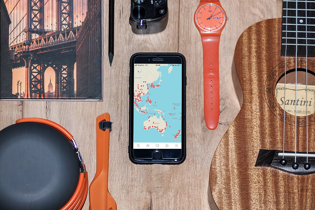
On the map, you can search for places and save markers. We started doing this long before embarking on our round-the-world trip. By the time we set off, half of the map was already covered with red dots – our “Magic Points.” Because many of them we managed to visit, even when we decided to skip some. Of course, we don’t get to visit everything that’s planned, but the main thing is that we manage to visit at least something!

Read also Useful apps for traveling
Maps.me is available on both Android and iOS for free. To use the maps you need to download them first. When you don’t need them anymore, you can easily delete them.
Minuses
But there are some downsides. For example, before, you could easily find any landmark in the world in maps.me search and put a mark on it. Now you need to first download a map of the area where it is located, which is very inconvenient when you do not know where it is or do not want to clog the memory of the phone. In these cases, you have to use a google map, find the coordinates, type in maps.me and save.
The second disadvantage is that sometimes maps.me takes you on a route where it is better not to go. The app gives you the shortest route, but it can be dangerous there. That’s why you always have to be logical and try not to use the path through some yards.
The third is that maps.me, unfortunately, does not show many houses, as is done on google maps, for example. And also, if you are looking for a certain house: a guesthouse or a hotel, maps.me may show it in the wrong place. So in such cases it is advisable to check with google maps. Again, we copy the coordinates from google maps into maps.me and build a route.
It still has many “phantom markers,” as we call them. These are objects that no longer exist, but they are still displayed on the map. For example, in South Korea, there are many phantom car and even train stations. The map also shows many trails that are impossible to find, or the starting point of a trail may be marked slightly earlier, leading you to turn in the wrong direction. Once, following one of these erroneous trails, we ended up at a very dangerous cliff. Therefore, it is not advisable to rely solely on the map; it is essential to pay attention to the trail markings and well-trodden paths. If there’s a well-trodden path at a fork, but maps.me suggests a faint one, it’s better to follow the more frequently used path. And if it leads you to your destination, it’s better to choose that one.
There can be amusing errors on the map as well. For example, it may show that you are somewhere completely different on the other side of the planet. Sometimes, the arrow may lag or point in the wrong direction. Occasionally, a pedestrian route may lead you over water, and the application might try to draw it in grey, assuming it’s a short distance and you can easily walk through it, but there’s actually no passage, and you end up having to detour several kilometers around that area.
But despite these shortcomings, it’s still a very cool app. It’s used by all the travelers we’ve met along the way and we highly recommend it!